Article Listing

MLP_12.5 2003May Shoreline Surveys

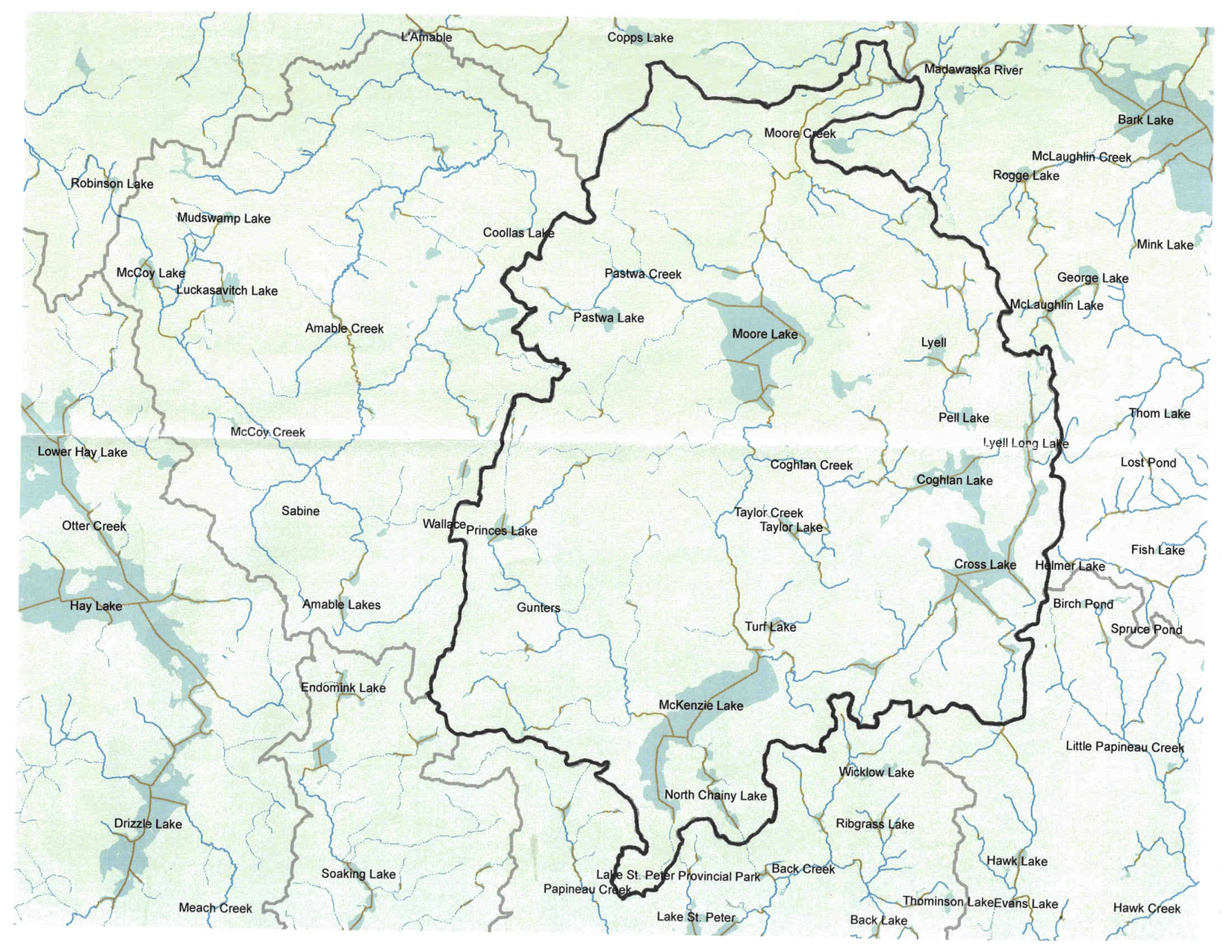
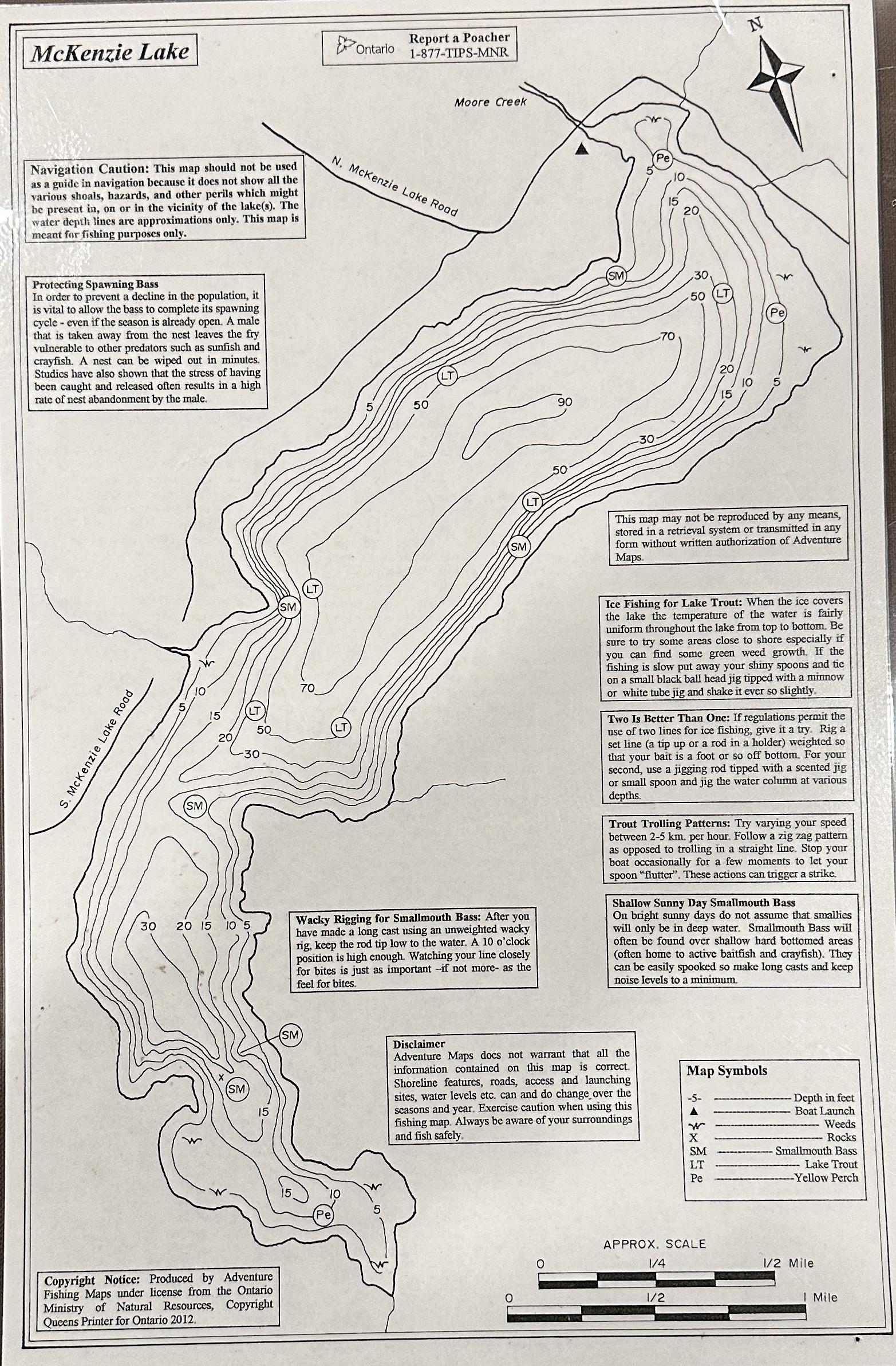
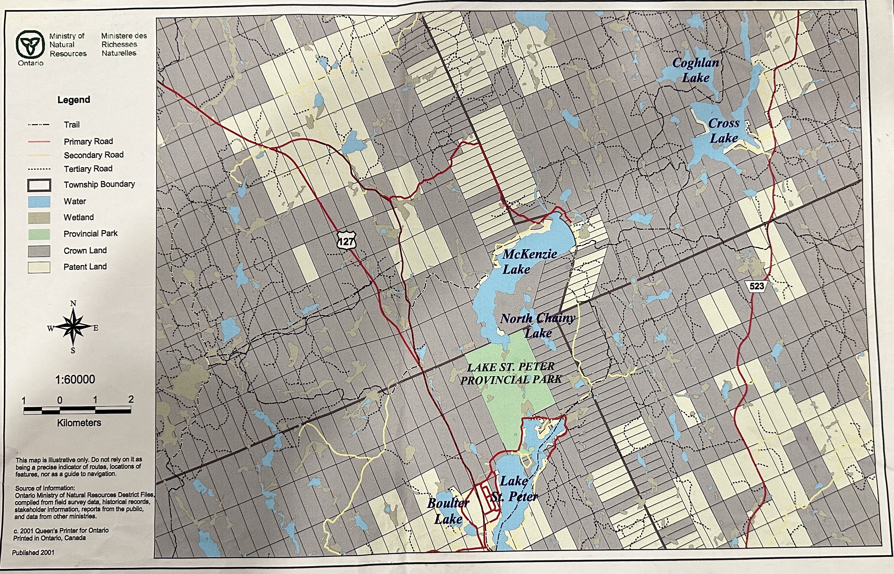
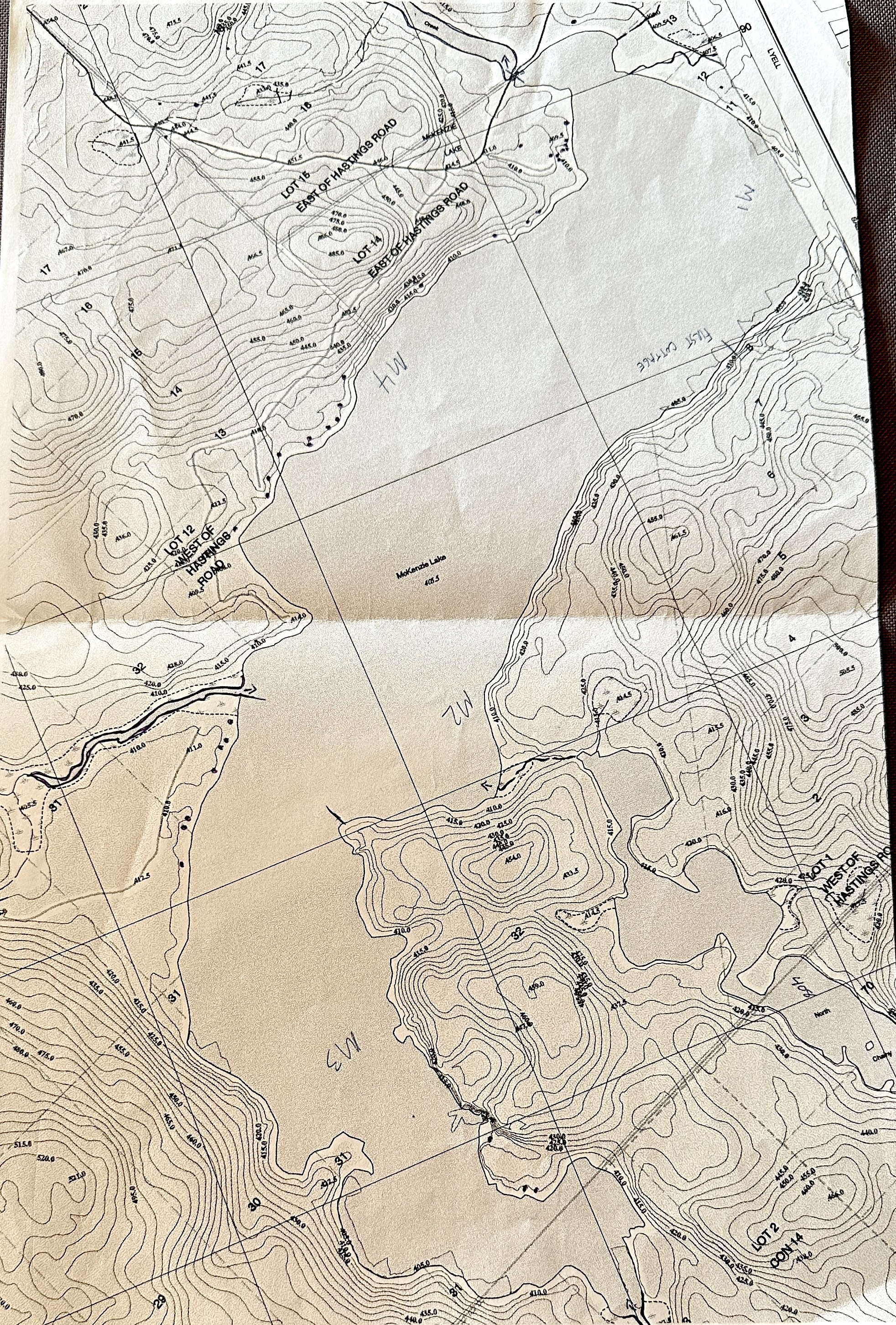
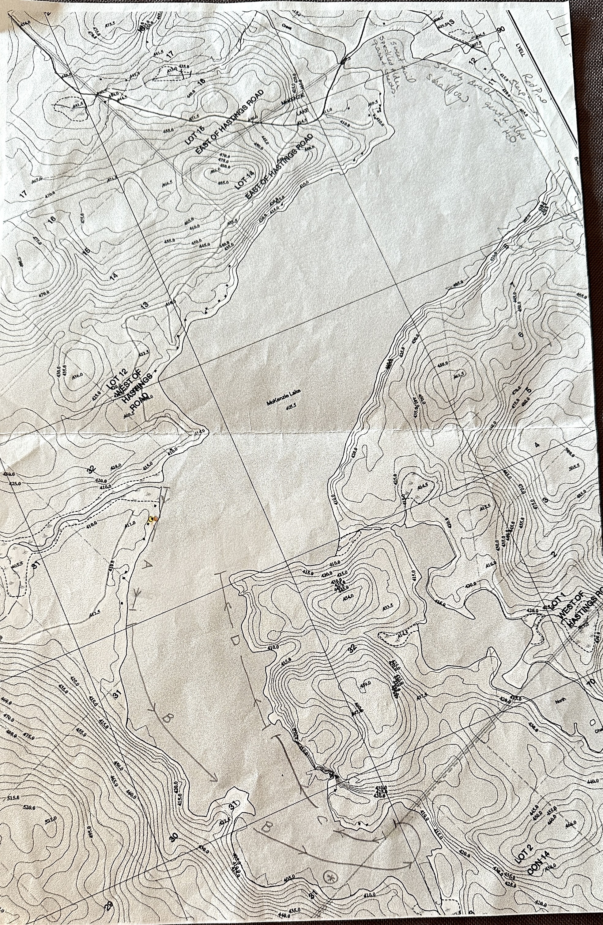
The following maps were used in the 2003 shoreline survey and assessment of water inlets/outlets around McKenzie Lake.

May2003 SitesforLakeSurveys

May2003 ShorelineSurvey

MLP_12.1 Watershed Map

The McKenzie Lake Watershed  v1.0

McKenzie Watershed

MLP_12.2 Bathymetry Map

You don't have a pdf plugin, but you can download the pdf file.

Bathymetry2

MLP_12.3 Old Lot Map

Old Lot Map

MLP_12.4 2001 Crown Map

In addition to this copy of a paper map. The active online crown map service can be accessed here:

https://www.lioapplications.lrc.gov.on.ca/CLUPA/index.html?viewer=CLUPA.CLUPA&locale=en-CA

2001 MNR CrownLand

You don't have a pdf plugin, but you can download the pdf file.

You don't have a pdf plugin, but you can download the pdf file.

About

McKLPOA is a nonprofit, member based, Association for the property owners surrounding McKenzie Lake and its watershed.

Services

Member Profile Menu

JRealtime Analytics Module

  • Stats on: 2025-04-01
  • Total visited pages: 65498
  • Total visitors: 65413
  • Average time: 00:00:00
  • Page per user: 1
  • Realtime stats
  • Users on page:
  • Visitors:
  • Logged users:
  • Total users:
  • Visitors counter
    0